Rio Bravo Conservation & Management Area
Topography
Generally speaking the entire area forms part of the Yucatan Platform and is underlain by massive beds of limestone. Faulting on a NE-SW alignment has created a series of blocks that are slipping downwards to the east, resulting in a series of escarpments across the landscape – Lalucha, Rio Bravo, Booth’s River and New River within the RBCMA with the sequence continuing eastwards to the outer cayes. The Booth’s River escarpment divides the RBCMA be- tween two land regions each with a number of land systems, briefly described below:
- The Bravo Hills – the upland (20-300 m asl) region west of the Booth’s River, underlain by hard limestone.
- The Northern Coastal Plain – the lowland (0-20 m asl) region east of Booth’s River, mainly underlain by softer limestone and covered with leached Pleistocene alluvia over extensive areas. The land systems can be divided into three basic types:
- Broad-leaf forest areas – typically over limestone with neutral to alkaline clay soils.
- Pine savannah areas – forming over leached Pleistocene alluvia, with nutrient-poor acid soils.
- Swamps – permanently waterlogged with organic mud over sand or clay.
Hydrology
Parts of three watersheds lie within the RBCMA:
- Some 60% of the area lies in the Rio Hondo watershed, including the mid-reaches of Booth’s River and the Rio Bravo and the headwaters of Blue Creek/Rio Azul. The latter flow west- wards before turning back through Guatemala and Mexico to form the international fron- tier. The RBCMA thus covers a significant part (c. 22%) of the Belizean part of the basin al- though this is a small part of the whole – only 18% of the Hondo system lies within Belize and only c. 4% on the RBCMA.
- The remaining 40% of the RBCMA lies in the New River basin, representing 21% of the entire system including most of the upper reaches of its main tributaries. The RBCMA also covers both banks of the southern third of the New River Lagoon, the largest inland water body in the country.
- The extreme south-eastern boundary of the RBCMA runs onto Labouring Creek, which is part of the Belize River system but represents an insignificant part of the total.

Habitat
Habitat
The ecosystems follow the work of Meerman & Sabido, 2001 updated 2011); Brokaw 1998 and Bridgewater et al. The three major ecosystems are Broadleaf Forests; Pine savannah formations; Wetland and aquatic ecosystems and briefly described here:
Tropical evergreen seasonal broadleaf forest over calcareous soils: Tehuantepec-Peten variant – the main high broad-leaf forest type.
Tropical evergreen seasonal broadleaf forest over calcareous soils: central-western variant – The main high broad-leaf forest type on the eastern RBCMA .
Tropical evergreen seasonal broadleaf forest over calcareous soils: central-eastern variant – Limited to the extreme south-eastern RBCMA.
Tropical evergreen seasonal broadleaf lowland swamp forest: tall variant – forests subject to seasonal flooding.
Tropical evergreen seasonal broadleaf lowland swamp forest: low variant – widespread throughout the RBCMA .
Evergreen lowland broadleaf shrubland dominated by leguminous shrubs- called bajo forest or bajo thicket by Brokaw.
Tropical evergreen seasonal broadleaf forest over lime-rich alluvium – used for the forests along the Rio Bravo.
Disturbed habitats
Broad-leaved lowland disturbed shrubland – re-growth (generally now well advanced) of areas cleared in the 1980s.
Evergreen lowland broadleaf shrubland: Miconia variant – used for a range of brushy mixed forest types transitional with the pine savannahs. Some areas qualify as tropical evergreen seasonal broadleaf forest on poor or sandy soils but are not mapped as such (though corrected in Meerman 2005).
Short-grass savannah with shrubs – the open savannahs with variable cover of broad-leaved shrubs.
Short-grass savannah with scattered needle-leaved trees – the open savannahs with scattered pine.
Tropical lowland tall herbaceous swamp – used for all extensive swamps and actually also including areas of tropical lowland reed-swamp.
Freshwater mangrove scrub – mapped on the Booth’s River marshes though patches occur on other rivers, especially on Ramgoat Creek where they are associated with marl flats (distinguished by Brokaw).

Aquatic
Fresh Water
The Rio Bravo Conservation and Management Area encompass seventy-five percent of the watersheds in Northern Belize, namely the New River, Rio Hondo, and Belize River watersheds.
Biodiversity
Flora
Long-term research programmes on the RBCMA ecosystems mean that the flora, and especially the woody flora, is relatively well known with some 745 species recorded to date. Diversity is average for a tropical system (50-60 woody species/ha in mesic forest) and the outstanding feature is that the area contains extensive tracts of land with complete and characteristic communities in fully functioning ecosystems. These include species characteristic of both the Peten and, especially in the northern RBCMA, to the dryer moist forests of the Yucatan. The pine savannah ecosystems are noteworthy as a rare vegetation type at a regional level (occurring in the Belizean coastal plains and the Mosquitia region of Honduras/Nicaragua), with a number of species known only from Belize. Several species are listed as being of conservation concern at national or international level Wildtracks 2005), often occurring as common species within their communities .

Fauna
The most important feature of the Rio Bravo is that it appears to support complete and fully functioning faunal communities characteristic of the area. Populations are for the most part healthy, including those of species that are under pressure elsewhere in the Central American range. Over 70 mammal species and 350 bird species have been recorded in the Rio Bravo.
The fauna has also been well-studied with research and survey projects covering all the major groups. In general terms diversity is high including foraging and breeding habitat for a range of species of conservation concern. As with the flora the most important characteristic is that they occur in fully functioning communities characteristic of the area, most clearly demonstrated by the diversity and relative commonness of top predators (large cats, birds of prey). The area has therefore been selected for re-introduction of the globally threatened Harpy Eagle, Harpia harpyja, a species highly dependent on extensive areas of unbroken forest.
Cultural Heritage
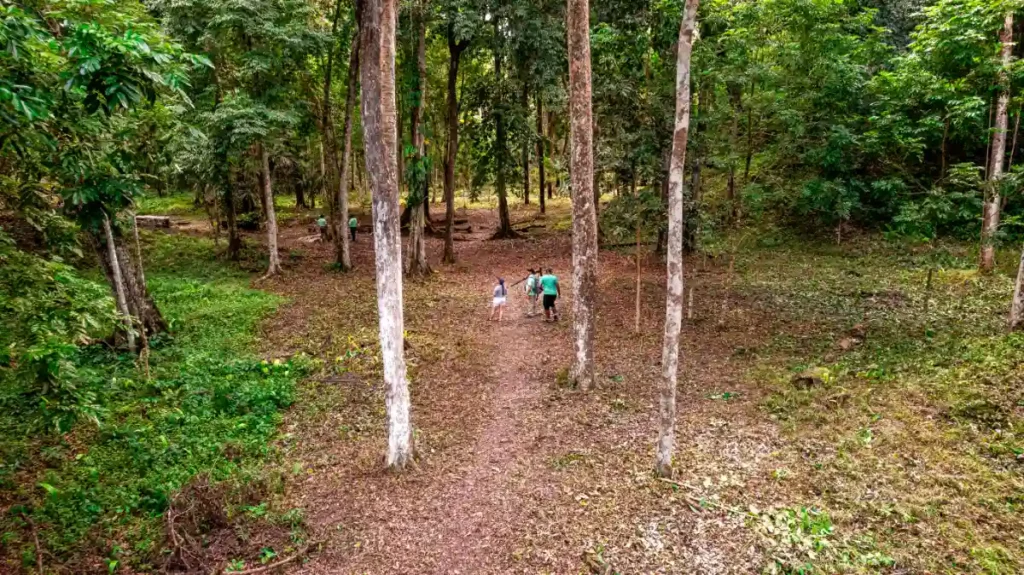
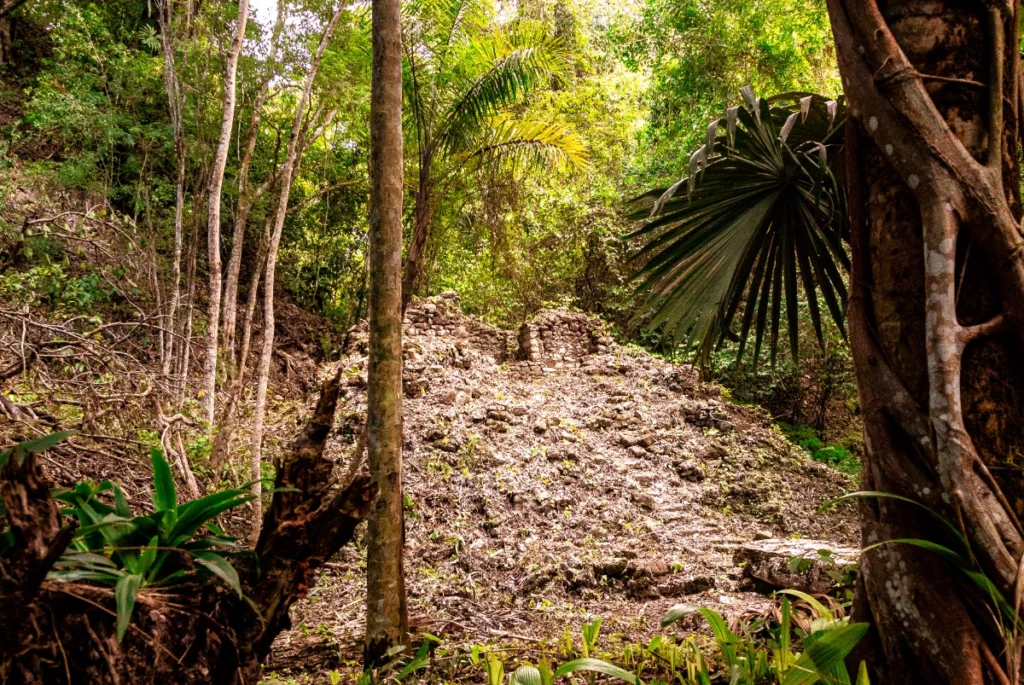
The area has an extraordinarily rich archaeological heritage. The Classic Mayan ceremonial centre of La Milpa is one of the largest in Belize and the main plaza is one the largest in the Maya world. Elsewhere there are numerous remains of dwellings ranging from simple house-mounds to elite dwellings including at least one, Dos Hombres, that rivals La Milpa in size. Over 60 substantial sites have been listed and others are located regularly. Although most of the visible remains date from the Late Classic Maya period, other finds range from pre-ceramic cultures through to the European contact, when New River Lagoon lay on the main access route to the upper Belize River Valley and the eastern Peten.
The forests on and around the Rio Bravo have also played a major role in the more recent history of the country. Mahogany logging probably dates back to the 18th century, from camps established on New River lagoon and Irish Creek. At this time the area further west was under the control of the resident Maya population although the expansion of logging – with camps established at Blue Creek, Hill Bank, Canal Bank, and Quam Hill (near Cedar Crossing) by the mid-19th century – brought them into increasing contact with the mahogany cutters.

Archaeology
La Milpa is the third largest ancient Maya site in Belize. The ceremonial center is built on a high limestone ridge and, with more than 24 courtyards and over 85 structures, is in the topmost rank of Mayan sites. The Great Plaza is one of the largest public spaces in the Maya world. It is flanked by four temple-pyramids with the tallest standing 24 m above the plaza floor. It contains two courts for the sacred Mayan ball-game, associated with ritual and sacrifice as well as recreation. At the back, in the most defensible position, is the acropolis or palace. There is also an administrative building with 13 gods of the heavens. Under the plaza there are two storage pits (chultuns) and a row of stelae is lined up along the west side in front of the main pyramids. Beyond the Great Plaza lie other plazas, pyramids and buildings, gradually merging into the surrounding jungle. In all, the core area is reckoned to cover one square kilometer.
Become a Donor
Programme for Belize would like to assist you with any concerns or with further questions you may have about the organization and our activities.
We need your support.
Join Our Community
Are you looking to help the environment, learn and develop your professional skills?
Get Involved With Us